

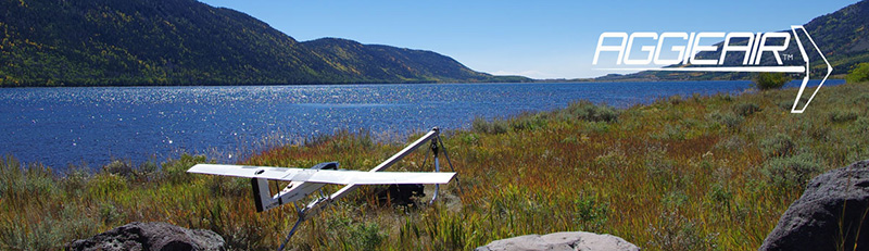
Using a Multispectral Autonomous Unmanned Aerial Remote Sensing Platform (AggieAir) for Riparian and Wetland Applications
Document Type
Conference Paper
Journal/Book Title/Conference
2011 IEEE International Geoscience and Remote Sensing Symposium (IGARSS)
Publisher
Institute of Electrical and Electronics Engineers
Location
Vancouver, BC
Publication Date
7-2011
Abstract
An autonomous, unmanned, aerial, remote sensing platform called AggieAir™ has been developed at Utah State University (USU) to produce multispectral aerial imagery. Its independence of a runway, low cost, and rapid turn-around time for imagery make it an efficient platform for applications in riparian areas and in wetlands management. Using third-party software, the imagery from AggieAir can be stitched together into mosaics, georeferenced, and used to classify vegetation and map riparian systems, substrates and fish habitat for hydraulic modeling, river morphology and restoration monitoring. Likewise, the multispectral mosaics can be used to monitor changes in meso-scale aquatic habitat features and invasive/native plant species, as well as delineate different types of wetlands for wetlands management. This paper introduces AggieAir and highlights some of the projects in riparian and wetlands applications in which it has been involved. AggieAir has also been involved with agricultural and biofuel applications.
Recommended Citation
Jensen, Austin; Hardy, Thomas; McKee, Mac; and Chen, YangQuan, "Using a Multispectral Autonomous Unmanned Aerial Remote Sensing Platform (AggieAir) for Riparian and Wetland Applications" (2011). AggieAir Presentations. Paper 24.
https://digitalcommons.usu.edu/aggieair_pres/24