

Document Type
Article
Journal/Book Title/Conference
Photogrammetric Engineering and Remote Sensing
Volume
80
Issue
12
Publisher
American Society for Photogrammetry and Remote Sensing
Publication Date
12-1-2014
First Page
1139
Last Page
1150
Abstract
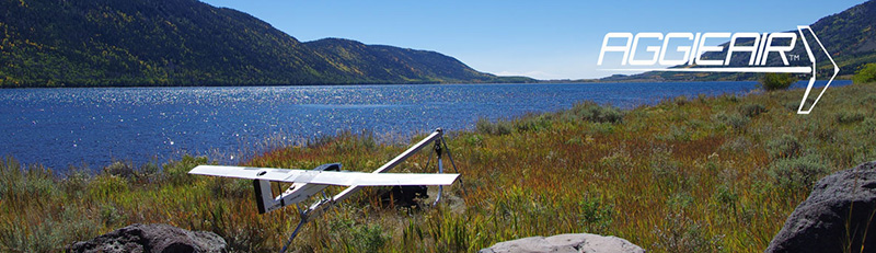
This research presents a new semi-automatic model for converting raw AggieAir™ footprints in visible and near-infrared (NIR) bands into reflectance images. AggieAir, a new unmanned aerial vehicle (UAV) platform, is flown autonomously using pre-programmed flight plans at low altitudes to limit atmospheric effects. The UAV acquires high-resolution, multispectral images and has a flight duration of about 30 minutes. The sensors on board are twin cameras with duplicate settings and automatic mode disabled. A white Barium Sulfate (BaSO4) panel is used for reflectance calibration and in situ irradiance measurements. The spatial resolution of the imagery is 25 cm; the radiometric resolution is 8-bit. The raw images are mosaicked and orthorectified and the model converts their digital numbers (DN) to reflectance values. Imagery, acquired around local solar noon over wetlands on the Great Salt Lake, Utah, is used to illustrate the results. The model generates high quality images and the results are good. The reflectance values of vegetation in the NIR, Green and Red bands extracted at the test locations are consistent. The image processing, reflectance calculations, accuracy issues, with the proposed method are discussed.
This research presents a new semi-automatic model for converting raw AggieAir™ footprints in visible and near-infrared (NIR) bands into reflectance images. AggieAir, a new unmanned aerial vehicle (UAV) platform, is flown autonomously using pre-programmed flight plans at low altitudes to limit atmospheric effects. The UAV acquires high-resolution, multispectral images and has a flight duration of about 30 minutes. The sensors on board are twin cameras with duplicate settings and automatic mode disabled. A white Barium Sulfate (BaSO4) panel is used for reflectance calibration and in situ irradiance measurements. The spatial resolution of the imagery is 25 cm; the radiometric resolution is 8-bit. The raw images are mosaicked and orthorectified and the model converts their digital numbers (DN) to reflectance values. Imagery, acquired around local solar noon over wetlands on the Great Salt Lake, Utah, is used to illustrate the results. The model generates high quality images and the results are good. The reflectance values of vegetation in the NIR, Green and Red bands extracted at the test locations are consistent. The image processing, reflectance calculations, accuracy issues, with the proposed method are discussed.
Recommended Citation
Zaman, Bushra; Jensen, Austin; Clemens, Shannon R.; and McKee, Mac, "Retrieval of Spectral Reflectance of High Resolution Multispectral Imagery Acquired with an Autonomous Unmanned Aerial Vehicle: AggieAir™" (2014). AggieAir Publications. Paper 14.
https://digitalcommons.usu.edu/aggieair_pubs/14